046 - Javorníky Mountains 3 (SK) (Rough ridge tour from Makov to Čadca) 15. 04. 2023
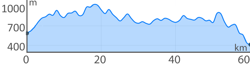
Javorníky Ridge is 80 km long and runs at a height of 1,000 metres from Wallachia to Kysucko. Already the Moravian part, which we passed a few years ago,
is quite challenging. But what awaits us in Slovakia on the way from Makov to Čadca, we really did not expect. With its elevation and difficult terrain,
it is undoubtedly the most difficult route we have ridden so far. But the beautiful views of Lysá hora and Malá Fatra are definitely worth it!
 Javorníky Ridge is 80 km long and runs at a height of 1,000 metres from Wallachia to Kysucko. Already the Moravian part, which we passed a few years ago,
is quite challenging. But what awaits us in Slovakia on the way from Makov to Čadca, we really did not expect. With its elevation and difficult terrain,
it is undoubtedly the most difficult route we have ridden so far. But the beautiful views of Lysá hora and Malá Fatra are definitely worth it!
Javorníky Ridge is 80 km long and runs at a height of 1,000 metres from Wallachia to Kysucko. Already the Moravian part, which we passed a few years ago,
is quite challenging. But what awaits us in Slovakia on the way from Makov to Čadca, we really did not expect. With its elevation and difficult terrain,
it is undoubtedly the most difficult route we have ridden so far. But the beautiful views of Lysá hora and Malá Fatra are definitely worth it!